Restrictions are lifting in Tasmania so we decided to visit a place Steve the surfer recently told us about, Marion Bay.
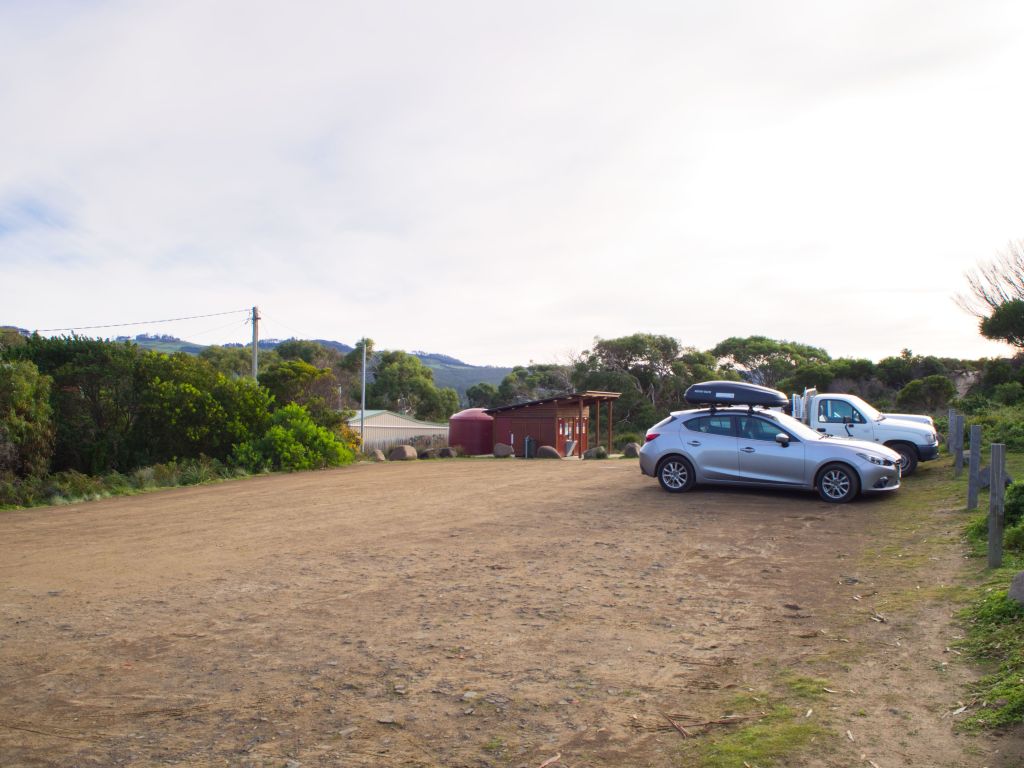
Entrance to the beach from the car park and lookout
Marion Bay is about 30 minutes drive from our home and was pretty amazing. On our trip if we said once, we said a dozen times, “Why haven’t we visited here before?” As we only explored half the beach we have a good reason to come back and do the rest.
Lets get some Marion Bay history and information out of the way first. The beach is 9 kms long and pure white sand. It is an excellent surf beach and also a bird sanctuary and has been designated an Important Bird Area.
This from Wikipedia – The system of beaches and mudflats has been identified by BirdLife International as a 584 ha Important Bird Area (IBA) because it regularly supports significant numbers of fairy terns and hooded plovers, as well as over 1% of the world population of pied oystercatchers. Red-necked stints use the IBA in substantial numbers, while other birds regularly recorded include curlew sandpipers, sooty oystercatchers and little terns.
Pacific Gull, Marion Bay
Marion Bay was named after a French explorer Marion du Fresne who recorded that he found large numbers of crayfish, lobsters and huge crabs, and the oysters there are good and abundant. More of the huge crabs later. Marion Bay oysters are sold all over Australia, Jenni reminded me that we regularly had Marion Bay oysters in our favourite sea food restaurant Reef in Brisbane.
Marion du Fresne recorded the first European sighting of one of the indigenous Aboriginal population. Unfortunately he is also recorded as the first European to shoot and kill an indigenous Aboriginal person. In an episode of extreme karma he then sailed to New Zealand where he was killed (and possibly eaten) by the indigenous Maori people.
The rest of this short blog I’ll do in picture captions.
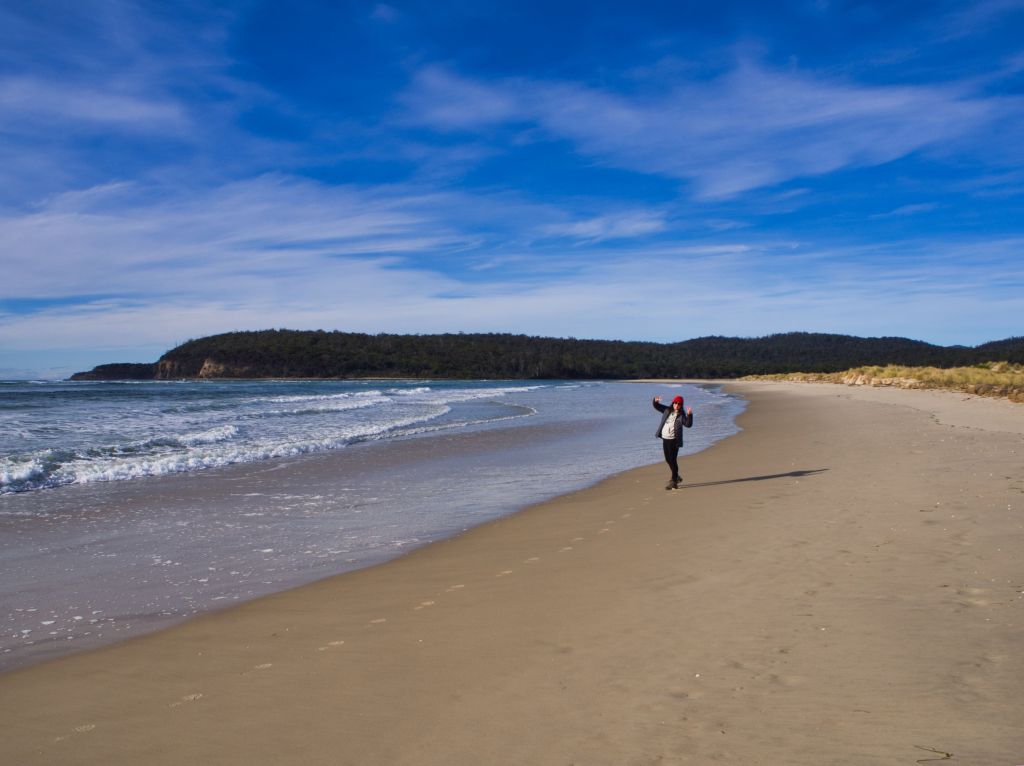
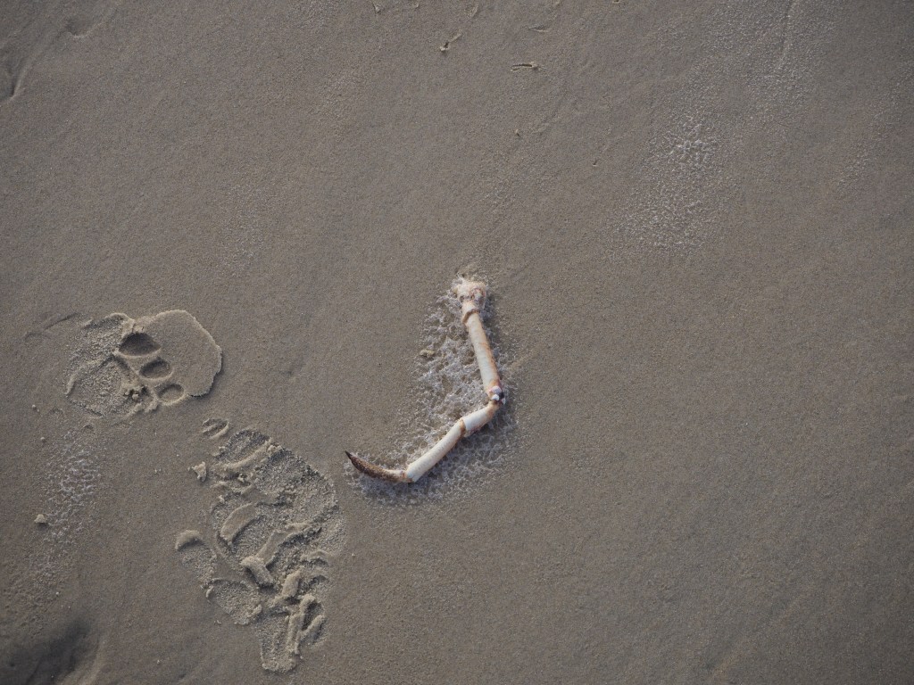
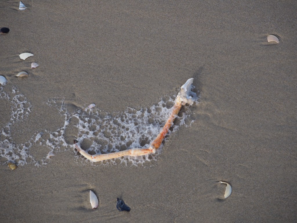
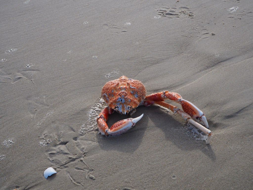
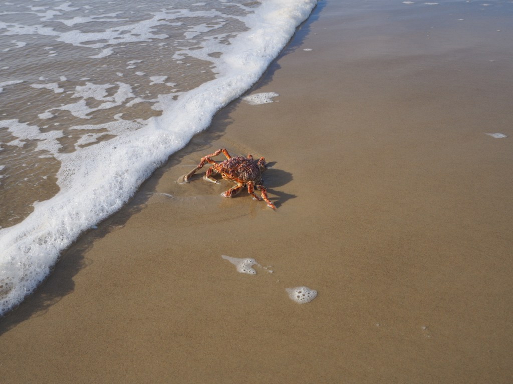
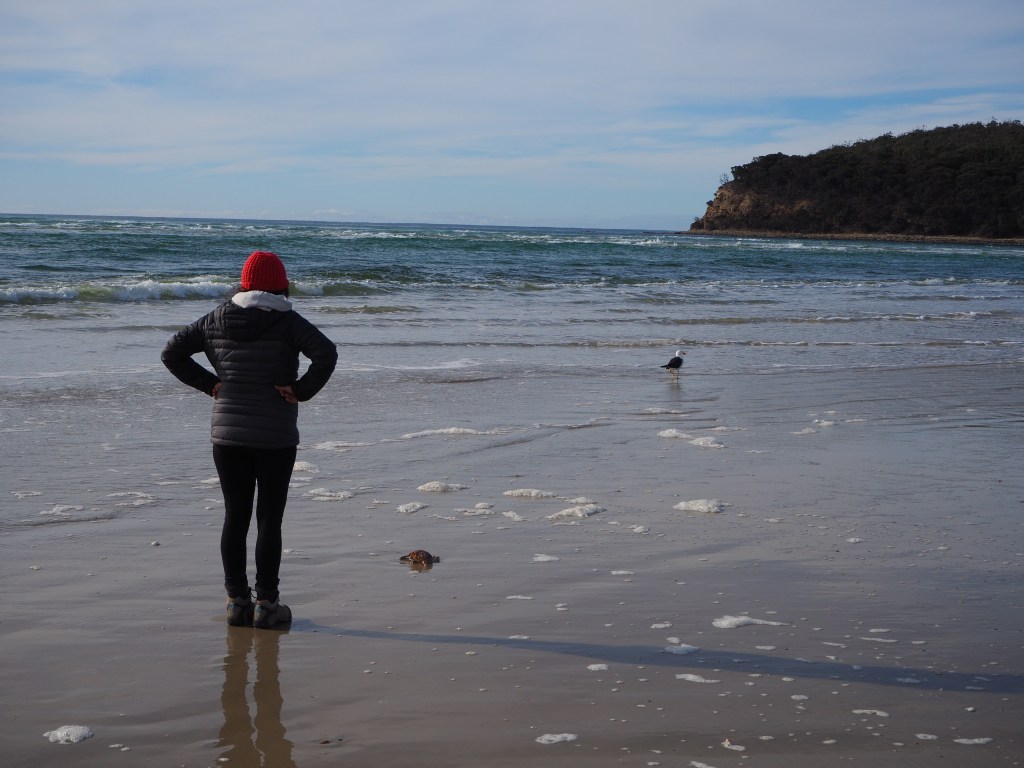
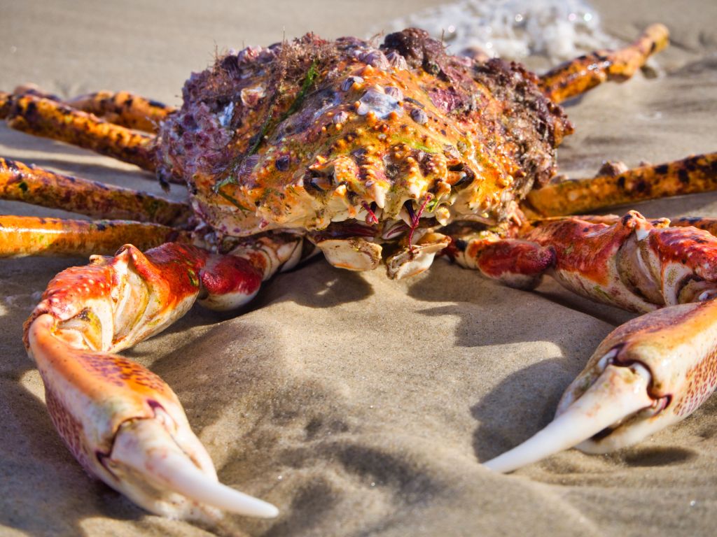
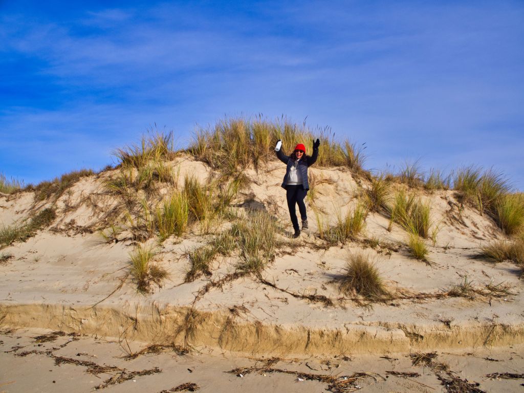
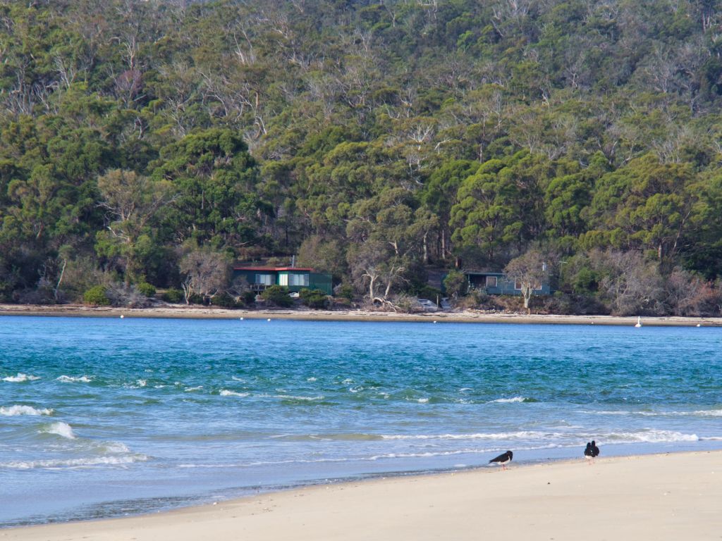
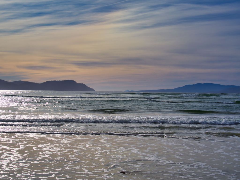
After crossing a narrow bridge across some eye wateringly beautiful salt marsh wetlands we drove through a small collection of beach shacks which makes up the Marion Bay enclave and parked in the car park next to the lookout platform.From the lookout we could see the beach stretch North-South. To the north Bream Creek cut across the beach blocking us walking that direction, it was also quite early so this is taken almost directly into the morning sunrise.Therefore we set off in a southerly direction towards the end of the spit.The first thing we noticed was the sand was pristine and white, bad picture I know. The second thing we noticed was a giant crab leg.Then another…… and another.Then farther along the beach we spotted a Pacific Gull eating something. When we got up to it we discovered it was eating the guts out of a whole crab. You can see the birds foot marks in the sand behind the crab. We were pretty amazed at the size of this thing.As it turned out gulls eating dead crabs was a common part of Marion Bay’s circle of life. As we walked along we’d often see a gull pecking at a crab carcass then as we got near the gull would fly off and after we went past it circled back and resumed its breakfast.This one though, we could clearly see from the distance, was still moving. The gull would peck it a bit and the crab would try and crawl away. The gull would then peck it a bit more. It clearly liked its crab extra fresh.Jenni was in full crab preservation mode at this point having a stare off with the gull. But as you could clearly see the prognosis for the crab was not good.As soon as we got past he was back at it again.After some research we discovered they are Tasmanian Giant Crabs. This is what they look like close up. As our friend Sherrill said, a face only a mother could love.Enough about crabs. To the north (and slightly east) the rising sun made the beach glow with the most wonderful light.To the south the pristine white sand stretched into the distance.Along the edge of the beach was a mixture of sheer sand cliffs and small sloping grass covered sand dunes. This is Jumping Jenni on her way down one of them.At the end of the spit we saw lots of birds resting in the dunes and on the sand. As this was a bird sanctuary and there were signs everywhere reminding you to leave the birds alone we turned back so we wouldn’t disturb them. We did however spot these beach shacks hidden under the forest canopy across the bay. A pretty neat place to have a home I’d say. The sun had risen a bit higher int he sky by this point leaving a muted orange colour in the higher whispy clouds. The island across the gap is the southern tip of Maria Island which we hope to visit very soon.As the sun rose higher the sand cliffs caught the light. The green rolling hills behind made a very nice scene. Jenni spotted this scene for me. I’m glad she did.
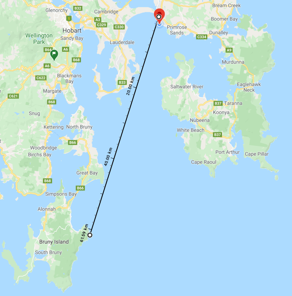
Our short day trip was over, we’d walked about 8 kms to the end of the beach and back. We drove back over the narrow bridge over the picturesque salt marshes. There was no stopping place otherwise I’d insert a picture. We’ve vowed to come back at dawn or sunset some day, park the car and walk back to the marshes to get the picture. Back at home the air was so clean and clear and we could clearly see Bruny Island from the back deck. To prove it I took this picture. Then worried about how this was possible.
How I prove the earth is flat, then prove it is not.
The earth is clearly flat. The cliff on the far right Cape Deslacs Nature Reserve near Cremorne and is 15 kms away, the middle cliff is near Bruny Island Nature Reserve on North Bruny Island and is 45 kms away and the one on the far left is near Adventure Bay on South Bruny island and is over 60 kms away. Now this should not be possible due to the curvature of the earth so I did some science. Our back deck is 37 metres above sea level. At that height the horizon is 21.7 kms away. Cape Deslacs is 28 m elevation so thats ok. The North Bruny we can see is 98 m elevation and South Bruny is 252 metres elevation.
Hello Walligan’s, I wanted permission to use your cover photo to attach to a story on a family history site as this area (Bream Creek up on the hill down to the Bay) was cleared and farmed by my gg grandfather and family in 1880’s. Johann Christian Bender. I’m not in Tasmania to capture a photo inland and there are few to be had looking back up the hill. Glad you enjoyed your time there. Denise
Hello Walligan’s,
Beautiful photos. I’m seeking permission to use your sand dunes/inland view picture to add to my story on a family history site as my gg grandfather cleared and farmed this area in the 1800’s. There are little to no photos online like this. Denise


Hello Walligan’s, I wanted permission to use your cover photo to attach to a story on a family history site as this area (Bream Creek up on the hill down to the Bay) was cleared and farmed by my gg grandfather and family in 1880’s. Johann Christian Bender. I’m not in Tasmania to capture a photo inland and there are few to be had looking back up the hill. Glad you enjoyed your time there. Denise
LikeLike
Hello Walligan’s,
Beautiful photos. I’m seeking permission to use your sand dunes/inland view picture to add to my story on a family history site as my gg grandfather cleared and farmed this area in the 1800’s. There are little to no photos online like this. Denise
LikeLike
Hi Fairylights10, yes go for it. Can you credit me on the use of the picture?
LikeLike